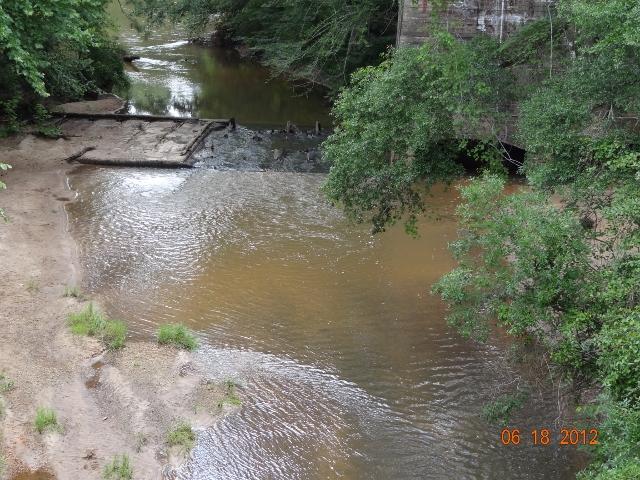
Little Choctawhatchee River at Old Power Dam Road/Dale CR 121
Current Water Quality
See Source Info tab to understand what these results mean
No data available
This status is based on the latest sample. Choctawhatchee Riverkeeper updates the status of this beach as soon as test results become available.
Little Choctawhatchee River at Old Power Dam Road/Dale CR 121 is sampled Other from May 1st to September 30th.
About Little Choctawhatchee River at Old Power Dam Road/Dale CR 121
Current Weather
Source Information
The State of Alabama does not regularly monitor inland swimming areas/beaches. The monitoring is done by Choctawhatchee Riverkeeper and its volunteers at sites where there is significant recreational use. Monitoring is done using methods (the Coliscan EasyGel protocol) utilized by the Alabama Water Watch (AWW) program. The Alabama Water Watch program has submitted QA/QC plans that have been approved for first-alert monitoring by Region 4 of the U.S. EPA. AWW trains, certifies and periodically recertifies volunteer monitors. Choctawhatchee Riverkeeper generally monitors sites in the Alabama portion of the river basin for E. coli from April to September. If resources allow these sites will at a minimum be monitored once prior to each major summer holiday. If additional resources are available and conditions allow, most sites will be monitored six times, once a month in April, May, June, July, August, September to check for contamination. Some sites will be monitored more frequently, typically weekly as part of an effort to get river segments use classification upgraded to include swimming and whole body contact recreation. All data will be posted in SWIM Guide. Sites that fail to meet water quality standards will be reported to the media county health departments, the local watershed management authority, posted to the blog on the Choctawhatchee Riverkeeper website and reported directly to members of Choctawhatchee Riverkeeper, the Wiregrass Canoe and Kayak Club and members of the SE Alabama Chapter of the Alabama Scenic River Trail. Sites that fail to meet water quality standards will be tested approximately once a week until they meet water quality standards. If they continue to fail to meet water quality standards, efforts will be made to post the sites as failing or have them posted. Sites that meet water quality standards in the early testing period will be tested prior to each major summer holiday. If at any point they fail to meet water quality standards, they will be tested as above. According to ALABAMA DEPARTMENT OF ENVIRONMENTAL MANAGEMENT WATER DIVISION – WATER QUALITY PROGRAM, for incidental water contact and whole body water-contact recreation, the bacterial quality of water is acceptable when a sanitary survey by the controlling health authorities reveals no source of dangerous pollution and when the geometric mean E. coli organism density does not exceed 126 colonies/100 ml nor exceed a maximum of 235 colonies/100 mL in any single sample in non-coastal waters. Our sites are GREEN when E. coli do not exceed a maximum of 235 colonies/100 ml in any single sample. Our sites are RED when the E. coli in a single sample exceeds a 235 colonies/100 mL in any single sample unless the sample is an outlier - for example it was taken in a first flush event or shortly after a significant runoff event.
Beaches Near This One
SEE All