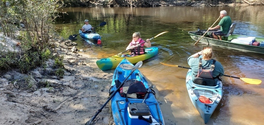
A popular put-in for both paddlers and power boaters, with the abandoned Stone Bridge about a mile upstream on the narrow but wide-enough blackwater south Georgia Little River.
Cook County Boat Ramp is between Adel in Cook County and Barney in Brooks County, on the southeast side of GA 76, and the northeast side (left bank) of Little River. Also known as Cook County Landing (GDOT).
From I-75 North, take exit 29, turn left to go west on GA 122, turn right in Barney at GA 76.
Downstream there's a beach, and a take out six river miles at Folsom Bridge Landing (GA 122).
Ramp: dirt and gravel access road to concrete ramp, PARKING: Free
WATER BODY: Little River, Lowest boatable 137? (4.2?), Highest safe 144? (11.2?), Gauge Hahira USGS 02318380 132.8?
Photo: John S. Quarterman, of WWALS Stone Bridge outing, 2020-05-16.
http://wwals.net/2020/04/11/reroute-little-river-cook-county-boat-ramp-upstream-to-stone-bridge-2020-05-16/
More about Cook County Boat Ramp:
http://wwals.net/maps/withlacoochee-river-water-trail/wrwt-map/wrwt-access/#Cook-County-Boat-Ramp
Keep your distance from other people.
Practicing social distancing is still essential. Only go to the beach if you are able to keep 6 feet or 2 meters away from others. Follow the instructions provided by your local health authorities. If your community has asked that you remain indoors and away from others, do so. Spending a day in any crowded place is the worst thing we can do for our most vulnerable right now and will counter our efforts to curb the virus’s spread.
A popular put-in for both paddlers and power boaters, with the abandoned Stone Bridge about a mile upstream on the narrow but wide-enough blackwater south Georgia Little River.
Cook County Boat Ramp is between Adel in Cook County and Barney in Brooks County, on the southeast side of GA 76, and the northeast side (left bank) of Little River. Also known as Cook County Landing (GDOT).
From I-75 North, take exit 29, turn left to go west on GA 122, turn right in Barney at GA 76.
Downstream there's a beach, and a take out six river miles at Folsom Bridge Landing (GA 122).
Ramp: dirt and gravel access road to concrete ramp, PARKING: Free
WATER BODY: Little River, Lowest boatable 137? (4.2?), Highest safe 144? (11.2?), Gauge Hahira USGS 02318380 132.8?
Photo: John S. Quarterman, of WWALS Stone Bridge outing, 2020-05-16.
http://wwals.net/2020/04/11/reroute-little-river-cook-county-boat-ramp-upstream-to-stone-bridge-2020-05-16/
More about Cook County Boat Ramp:
http://wwals.net/maps/withlacoochee-river-water-trail/wrwt-map/wrwt-access/#Cook-County-Boat-Ramp
Swim Guide shares the best information we have at the moment you ask for it. Always obey signs at the beach or advisories from official government agencies. Stay alert and check for other swimming hazards such as dangerous currents and tides. Please report your pollution concerns so Affiliates can help keep other beach-goers safe. Swim Guide, "Swim Drink Fish icons," and associated trademarks are owned by SWIM DRINK FISH CANADA. See Legal.
© SWIM DRINK FISH CANADA, 2011 - 2023