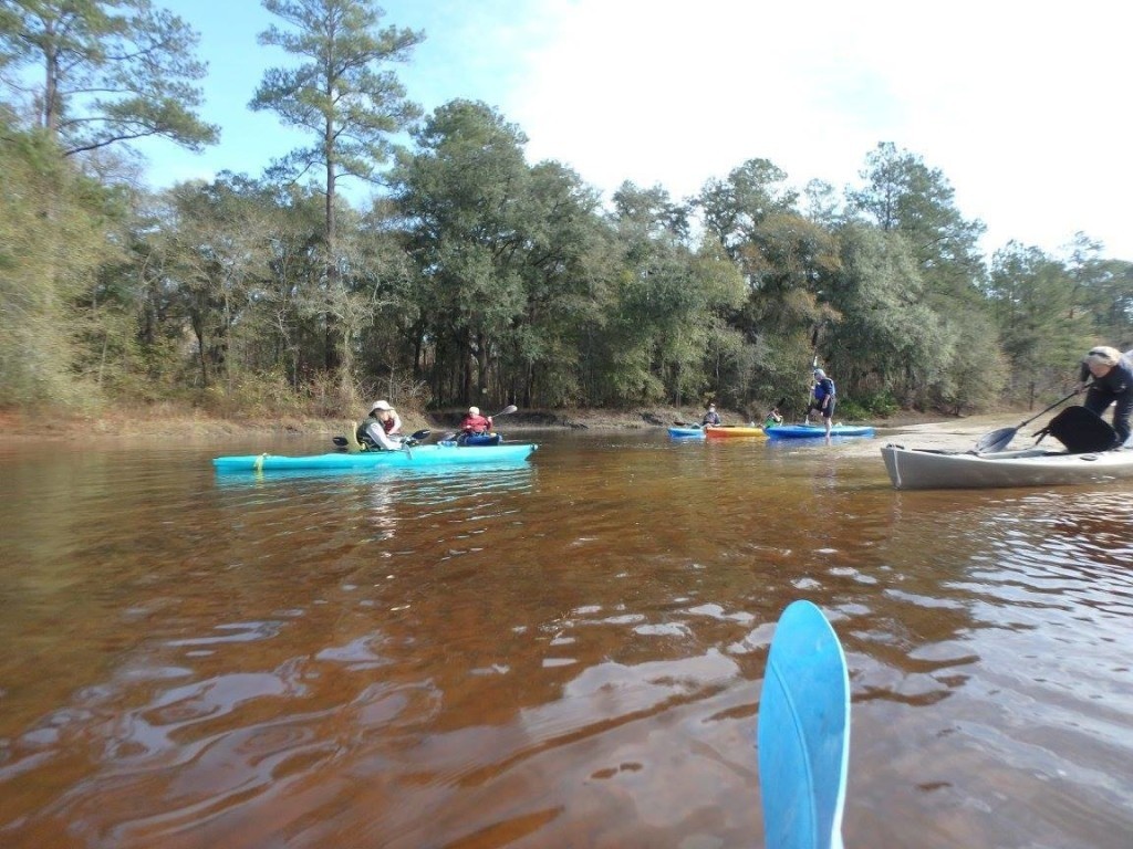
Folsom Bridge is the Little River takeout downstream from Cook County Boat Ramp.
Usually lots of mussels. Fish jump in the spring, and bed in pools in this idyllic blackwater south Georgia River.
For those from elsewhere: fish make beds for laying their eggs. The beds appear as round and slightly concave areas cleared in the sand, about a foot in diameter.
Directions: From north or south, take I-75, Exit 29, head west on GA 122, turn right on Wells Road, and immediate left down to the river.
There is no boat ramp; access is by the sandy river bank.
Lowest boatable 137? (4.2?), Highest safe 144? (11.2?), Gauge Hahira USGS 02318380 132.8?
Downstream, it's 25 river miles to Troupville Boat Ramp, with the Little River meandering through swamp much of the way.
The closer takeout at the next public road is actually not public, so we don't list it.
Photo: Gretchen Quarterman, WWALS Little River paddle, 2016-01-16
http://wwals.net/2016/01/17/pictures-a-lovely-short-little-river-paddle-on-a-warm-winter-day-2016-01-16/
More about Folsom Bridge Landing:
http://wwals.net/maps/withlacoochee-river-water-trail/wrwt-map/wrwt-access/#Folsom-Bridge-Landing
Keep your distance from other people.
Practicing social distancing is still essential. Only go to the beach if you are able to keep 6 feet or 2 meters away from others. Follow the instructions provided by your local health authorities. If your community has asked that you remain indoors and away from others, do so. Spending a day in any crowded place is the worst thing we can do for our most vulnerable right now and will counter our efforts to curb the virus’s spread.
Folsom Bridge is the Little River takeout downstream from Cook County Boat Ramp.
Usually lots of mussels. Fish jump in the spring, and bed in pools in this idyllic blackwater south Georgia River.
For those from elsewhere: fish make beds for laying their eggs. The beds appear as round and slightly concave areas cleared in the sand, about a foot in diameter.
Directions: From north or south, take I-75, Exit 29, head west on GA 122, turn right on Wells Road, and immediate left down to the river.
There is no boat ramp; access is by the sandy river bank.
Lowest boatable 137? (4.2?), Highest safe 144? (11.2?), Gauge Hahira USGS 02318380 132.8?
Downstream, it's 25 river miles to Troupville Boat Ramp, with the Little River meandering through swamp much of the way.
The closer takeout at the next public road is actually not public, so we don't list it.
Photo: Gretchen Quarterman, WWALS Little River paddle, 2016-01-16
http://wwals.net/2016/01/17/pictures-a-lovely-short-little-river-paddle-on-a-warm-winter-day-2016-01-16/
More about Folsom Bridge Landing:
http://wwals.net/maps/withlacoochee-river-water-trail/wrwt-map/wrwt-access/#Folsom-Bridge-Landing
Swim Guide shares the best information we have at the moment you ask for it. Always obey signs at the beach or advisories from official government agencies. Stay alert and check for other swimming hazards such as dangerous currents and tides. Please report your pollution concerns so Affiliates can help keep other beach-goers safe. Swim Guide, "Swim Drink Fish icons," and associated trademarks are owned by SWIM DRINK FISH CANADA. See Legal.
© SWIM DRINK FISH CANADA, 2011 - 2023