False Creek East (VCH)

Vancouver, British Columbia

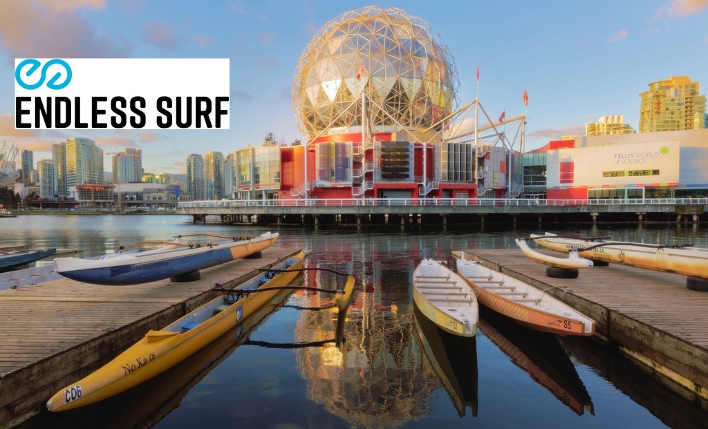
This is not a beach for swimming, but is included on Swim Guide as a recreation site for kayaking, dragon boating, paddleboarding, sailing, and boating.

False Creek was once a tidal flat natural estuary and its riparian vegetation acted as a buffer and for both run-off and tidal waters. Fresh water streams flowed into the area and created natural water filtration and flushing right up until the introduction of industry, most predominantly the rail industry. To accommodate its development, half of False Creek was filled to create trainyards.

The rise of industry resulted in the loss of False Creek’s natural flushing and filtration systems. Industrial operations discharged toxic materials directly into False Creek until about 1970, including high concentrations of cadmium, mercury, lead – which remain in the sediments today, mostly in the eastern end.

FIRST NATIONS HISTORY:
Originally, False Creek was a waterway that was shared by the Musqueam, Squamish, and Tsleil-Waututh First Nations. This area was rich in flora and fauna and was used by Coast Salish nations for fishing and hunting. It was known for its sandbars, where Musqueam, Tsleil-Waututh, and Squamish women would till oyster and clam beds to encourage reproduction.

First Nations Information From:
https://falsecreekcc.ca/false-creek-community-centre-true-or-false-false-creek-was-man-made-thats-how-it-got-its-name/

http://jdyck.weebly.com/uploads/1/9/1/5/19153179/goodbye_snauq.pdf

Photo: Yuanxi Zhou - Flickr

COVID-19

Keep your distance from other people.

Practicing social distancing is still essential. Only go to the beach if you are able to keep 6 feet or 2 meters away from others. Follow the instructions provided by your local health authorities. If your community has asked that you remain indoors and away from others, do so. Spending a day in any crowded place is the worst thing we can do for our most vulnerable right now and will counter our efforts to curb the virus’s spread.

Water Quality
  • Met water quality standards less than 60% of the time

  • Historical Status
  • This status is based on the latest sample, taken on September 27th, 2022. Fraser Riverkeeper updates the status of this beach as soon as test results become available. These results were posted to Swim Guide on September 29th, 2022 at 3:47 PM.
For water quality icon legend, click:  
Current Weather
6°C
A few clouds
Monitoring Frequency

False Creek East (VCH) is sampled weekly from May 10th to October 10th.

Source Information

Vancouver Coastal Health (VCH) monitors the water quality at 31 Vancouver-area beaches. Sampling is conducted during the height of swim season (May – September) and for the annual Polar Bear Swim (December).

VCH follows the Canadian Recreational Water Guidelines. Recreational water is considered safe if the geometric mean result is under 200 E.coli/100mL based on the previous last five samples or a single sample limit of under 400 E.coli/100mL. Should the results exceed the guidelines or in the event of a known hazard or spill, the Medical Health Officer will make an assessment of the risk to human health. If there is a risk to human health, a warning sign will be posted at the beach stating “This Water is Contaminated and Unsafe for Swimming.” Results are communicated on the Vancouver Coastal Health website. Data is shared on Swim Guide according to these results, as soon as they become available. Data is typically available on Thursdays or Fridays

Recreational water quality for a beach is determined by E. coli counts from the Greater Vancouver Regional District Water Quality Laboratory.

A beach is marked Green when geometric mean results are under 200 E.coli/100 mL and single sample results are below 400 E.coli/100mL.

A beach is marked Red when the geometric mean results are equal to or above 200 E.coli/100 mL water or single sample results are above 400 E.coli/100 mL.

A beach is marked Grey when there are no current results or there is no available information

Read more
Water Quality Graph

False Creek East (VCH)

Vancouver, British Columbia

COVID-19

Keep your distance from other people.

Practicing social distancing is still essential. Only go to the beach if you are able to keep 6 feet or 2 meters away from others. Follow the instructions provided by your local health authorities. If your community has asked that you remain indoors and away from others, do so. Spending a day in any crowded place is the worst thing we can do for our most vulnerable right now and will counter our efforts to curb the virus’s spread.

Water Quality
  • Met water quality standards less than 60% of the time
  • Historical Status
  • This status is based on the latest sample, taken on September 27th, 2022. Fraser Riverkeeper updates the status of this beach as soon as test results become available. These results were posted to Swim Guide on September 29th, 2022 at 3:47 PM.
For water quality icon legend, click:  
Current Weather
6°C
A few clouds

This is not a beach for swimming, but is included on Swim Guide as a recreation site for kayaking, dragon boating, paddleboarding, sailing, and boating.

False Creek was once a tidal flat natural estuary and its riparian vegetation acted as a buffer and for both run-off and tidal waters. Fresh water streams flowed into the area and created natural water filtration and flushing right up until the introduction of industry, most predominantly the rail industry. To accommodate its development, half of False Creek was filled to create trainyards.

The rise of industry resulted in the loss of False Creek’s natural flushing and filtration systems. Industrial operations discharged toxic materials directly into False Creek until about 1970, including high concentrations of cadmium, mercury, lead – which remain in the sediments today, mostly in the eastern end.

FIRST NATIONS HISTORY:
Originally, False Creek was a waterway that was shared by the Musqueam, Squamish, and Tsleil-Waututh First Nations. This area was rich in flora and fauna and was used by Coast Salish nations for fishing and hunting. It was known for its sandbars, where Musqueam, Tsleil-Waututh, and Squamish women would till oyster and clam beds to encourage reproduction.

First Nations Information From:
https://falsecreekcc.ca/false-creek-community-centre-true-or-false-false-creek-was-man-made-thats-how-it-got-its-name/

http://jdyck.weebly.com/uploads/1/9/1/5/19153179/goodbye_snauq.pdf

Photo: Yuanxi Zhou - Flickr

Monitoring Frequency

False Creek East (VCH) is sampled weekly from May 10th to October 10th.

Source Information

Vancouver Coastal Health (VCH) monitors the water quality at 31 Vancouver-area beaches. Sampling is conducted during the height of swim season (May – September) and for the annual Polar Bear Swim (December).

VCH follows the Canadian Recreational Water Guidelines. Recreational water is considered safe if the geometric mean result is under 200 E.coli/100mL based on the previous last five samples or a single sample limit of under 400 E.coli/100mL. Should the results exceed the guidelines or in the event of a known hazard or spill, the Medical Health Officer will make an assessment of the risk to human health. If there is a risk to human health, a warning sign will be posted at the beach stating “This Water is Contaminated and Unsafe for Swimming.” Results are communicated on the Vancouver Coastal Health website. Data is shared on Swim Guide according to these results, as soon as they become available. Data is typically available on Thursdays or Fridays

Recreational water quality for a beach is determined by E. coli counts from the Greater Vancouver Regional District Water Quality Laboratory.

A beach is marked Green when geometric mean results are under 200 E.coli/100 mL and single sample results are below 400 E.coli/100mL.

A beach is marked Red when the geometric mean results are equal to or above 200 E.coli/100 mL water or single sample results are above 400 E.coli/100 mL.

A beach is marked Grey when there are no current results or there is no available information

Read more
Water Quality Graph

  Beach Location Water Quality
Vancouver, British Columbia
Swim Guide
is supported by
* The RBC Foundation

Swim Guide shares the best information we have at the moment you ask for it. Always obey signs at the beach or advisories from official government agencies. Stay alert and check for other swimming hazards such as dangerous currents and tides. Please report your pollution concerns so Affiliates can help keep other beach-goers safe.

Swim Guide, "Swim Drink Fish icons," and associated trademarks are owned by SWIM DRINK FISH CANADA. See Legal.

© SWIM DRINK FISH CANADA, 2011 - 2023