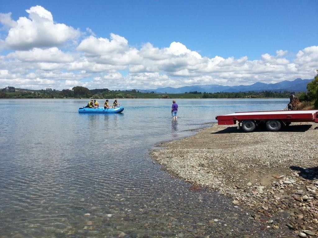
Kina Ski Lanes at Boat Ramp

Tasman, Tasman

Kina Ski Lanes is best accessed from Baigent Reserve at the end of the Kina Peninsula, about a 10 minute drive south of Motueka. The main recreational use is water skiing. During the peak Christmas-January period the boat ramp has about 20-50 visitors a day.

Water Quality
  • No data available

  • Current Status
  • This status is based on the latest sample, taken on April 30th, 2017. The Swim Guide - New Zealand updates the status of this beach as soon as test results become available. These results were posted to Swim Guide on April 29th, 2017 at 5:35 PM.
For water quality icon legend, click:  
Monitoring Frequency

Kina Ski Lanes at Boat Ramp is sampled weekly from November 1st to February 15th.

Source Information

Tasman Regional Council monitors water quality at popular swimming beaches throughout the Tasman region.

Water quality data on Swim Guide is sourced from the LAWA Can I Swim Here? website. www.lawa.org.nz/swim

At this site, water is regularly tested for levels of Enterococci during the summer months. This faecal indicator bacteria is used to indicate the level of harmful pathogens in the water.

See information on recreational water quality monitoring in New Zealand in this LAWA factsheet: https://www.lawa.org.nz/learn/factsheets/coastal-and-freshwater-recreation-monitoring/

Beach sites are shown as a GREEN swim icon if the latest Enterococci test result was in the range of 0 - 280 Enterococci / 100 mL.

Beach sites are shown as a RED swim icon if the latest test result exceeded 280 Enterococci / 100 mL or frequently exceeds the standard or there is a temporary water quality issue outside the routine testing programme (e.g. sewage overflow).

See information on the standards for recreational water quality monitoring in New Zealand in the 'What do the swim icons mean?' LAWA factsheet.

LAWA recommends for all sites, to avoid swimming for 2 - 3 days after significant rain, even for sites that normally have good water quality.

A good rule of thumb is to check that you can see your toes in knee deep water.

See www.lawa.org.nz/swim for up to date information on current warnings and alerts, weather conditions, tides, real-time water temperatures, what facilities are available, the monitoring history at this site and helpful factsheets.

Read more
Water Quality Graph

Kina Ski Lanes at Boat Ramp

Tasman, Tasman

Water Quality
  • No data available
  • Current Status
  • This status is based on the latest sample, taken on April 30th, 2017. The Swim Guide - New Zealand updates the status of this beach as soon as test results become available. These results were posted to Swim Guide on April 29th, 2017 at 5:35 PM.
For water quality icon legend, click:  

Kina Ski Lanes is best accessed from Baigent Reserve at the end of the Kina Peninsula, about a 10 minute drive south of Motueka. The main recreational use is water skiing. During the peak Christmas-January period the boat ramp has about 20-50 visitors a day.

Monitoring Frequency

Kina Ski Lanes at Boat Ramp is sampled weekly from November 1st to February 15th.

Source Information

Tasman Regional Council monitors water quality at popular swimming beaches throughout the Tasman region.

Water quality data on Swim Guide is sourced from the LAWA Can I Swim Here? website. www.lawa.org.nz/swim

At this site, water is regularly tested for levels of Enterococci during the summer months. This faecal indicator bacteria is used to indicate the level of harmful pathogens in the water.

See information on recreational water quality monitoring in New Zealand in this LAWA factsheet: https://www.lawa.org.nz/learn/factsheets/coastal-and-freshwater-recreation-monitoring/

Beach sites are shown as a GREEN swim icon if the latest Enterococci test result was in the range of 0 - 280 Enterococci / 100 mL.

Beach sites are shown as a RED swim icon if the latest test result exceeded 280 Enterococci / 100 mL or frequently exceeds the standard or there is a temporary water quality issue outside the routine testing programme (e.g. sewage overflow).

See information on the standards for recreational water quality monitoring in New Zealand in the 'What do the swim icons mean?' LAWA factsheet.

LAWA recommends for all sites, to avoid swimming for 2 - 3 days after significant rain, even for sites that normally have good water quality.

A good rule of thumb is to check that you can see your toes in knee deep water.

See www.lawa.org.nz/swim for up to date information on current warnings and alerts, weather conditions, tides, real-time water temperatures, what facilities are available, the monitoring history at this site and helpful factsheets.

Read more
Water Quality Graph

  Beach Location Water Quality
Kaiteriteri, Tasman
Mapua, Tasman
Motueka Valley, Tasman
Motueka, Tasman
Swim Guide
is supported by
* The RBC Foundation

Swim Guide shares the best information we have at the moment you ask for it. Always obey signs at the beach or advisories from official government agencies. Stay alert and check for other swimming hazards such as dangerous currents and tides. Please report your pollution concerns so Affiliates can help keep other beach-goers safe.

Swim Guide, "Swim Drink Fish icons," and associated trademarks are owned by SWIM DRINK FISH CANADA. See Legal.

© SWIM DRINK FISH CANADA, 2011 - 2023