Current Water Quality
See Source Info tab to understand what these results mean
No data available
This status is based on the latest sample. Suwannee Riverkeeper of WWALS Watershed Coalition, Inc. updates the status of this beach as soon as test results become available.
Knights Ferry Boat Ramp is sampled Weekly from January 1st to December 31st.
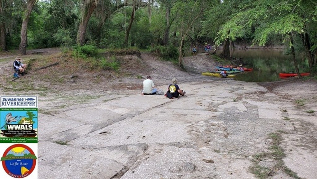
About Knights Ferry Boat Ramp
Current Weather
Source Information
The WWALS Watershed Coalition (WWALS) and Suwannee Riverkeeper staff and volunteers collect, process, and analyze water quality data for the Withlacoochee River. Water is sampled weekly, year-round. Water is sampled for E. coli. The City of Valdosta samples three times a week down to the GA-FL line, and Madison Health samples once or twice a week below that. Farther downstream, other Florida agencies also sample after a sewage spill. Results are shared one to three days after sampling. A beach is marked GREEN when sample results are below 126 E .coli / 100 ML water. A beach is marked RED when a recent sample result is 410 E. coli/100 mL, or the geometric mean concentration (minimum of five samples) is equal to or above 126 E. coli / 100 ML water. A beach is marked GREY when there are no current results, or there is no available information. Test results are expressed as Most Probable Number (MPN) of E.coli per 100 ml by using the IDEXX Quanti-Tray/2000 MPN Table, and in colony-forming units (CFU) per 100 milli-Liters of water (cfu/100 mL). To report a contamination issue, please use this form: https://forms.gle/ye2FdfaF6UknuxgH7 Or call: 850-290-2350 / send email to contact@suwanneeriverkeeper.org Please visit http://wwals.net/issues/testing/ for more information. Please visit for more http://wwals.net/ information.
Beaches Near This One
SEE All